Maps
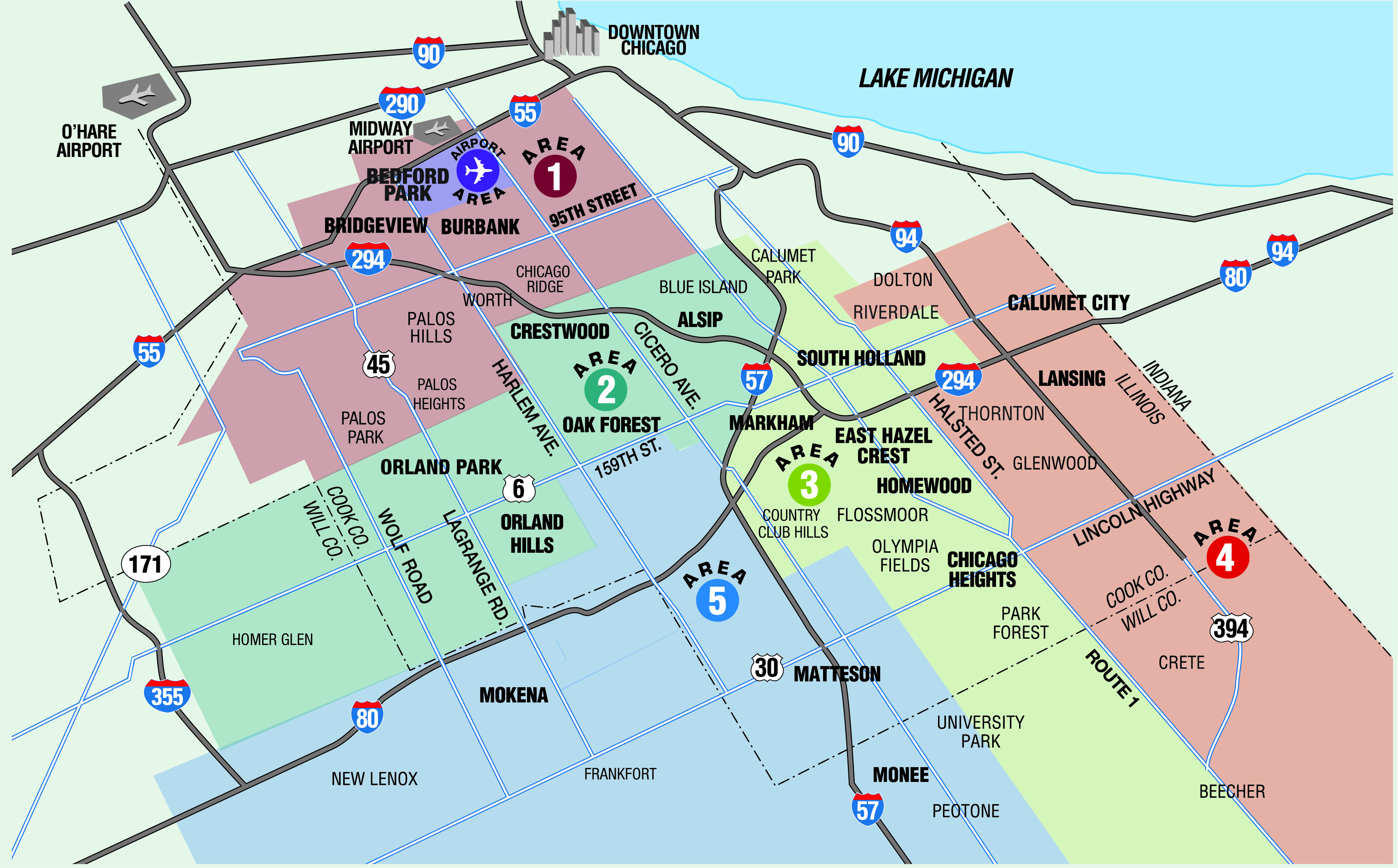
The Chicago Southland is comprised of the south/southwest suburbs of Chicago and covers over 400 square miles, with a population of just under 1 million. Many major interstates transverse the region including Interstates: 55, 57, 80, 94, 294, 355.
The Chicago Southland is bordered in the north by Midway Airport, in the south by Peotone, in the west by Homer Glen and in the east by the Illinois/Indiana state border.
Whether you are looking for directions to the closest international airport, hotel brands you know and trust, events facilities or wanting to venture out and see the Chicago Southland, our map has you covered for all of your navigational needs.
- Chicago Southland Area Map
- Chicago Southland Perspective Map
- Chicago Southland Interactive Map
- Chicago Southland Mileage Map











THINGS TO DO
EVENTS
DINING
ACCOMMODATIONS
PLAN YOUR TRIP
BLOG
MEETINGS
SPORTS
GROUP TOURS
SOCIAL EVENTS
MEDIA
MEMBERSHIP
ABOUT US
FACEBOOK
YOUTUBE
TWITTER
INSTAGRAM
LINKEDIN
TRIP ADVISOR
CONTACT US SITE MAP PRIVACY POLICY & DISCLAIMER
© Copyright 2001-2024 Visit Chicago Southland. All Rights Reserved. Developed by J Rudny, LLC
19900 Governors Drive, Suite 200| Olympia Fields, IL 60461-1057
(708) 895-8200 | Toll Free (888) 895-8233 | FAX (708) 895-8288